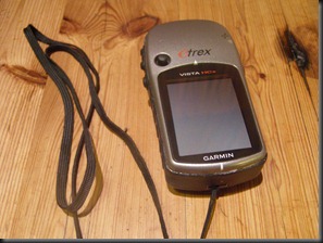
Five years ago, I was given a wonderful gift. It was a Garmin e-trex vista HCX GPS. A nifty little handheld, waterproof “hiking type” unit, that slips into your jacket pocket.
At the time, I was pleased to receive it, and was sure it would come in use out there in the veld somehow. But I had no idea how much I was to end up enjoying it.
I suppose this has something to do with the fact that us humans are great measurers of things.
And many of us outdoor types all the more so. Perhaps I speak for myself here, but it seems we do a great deal of recording of measures. Water temperatures, fish lengths, weights and condition factors, wind directions, fly size, barometric pressure, moon phase, number of fish caught, number of takes, number of rises. I could go on.
And maps…we love maps.

The GPS brought all this together. I learnt how to download the data onto the PC, and save the little red lines of where I had driven or hiked. Now I colour code hikes in green, drives in red, and canoe or float tube routes in blue. Way points are starting to fall into a system in terms of how to name them and what symbol to use. And then there are custom symbols you can draw yourself. Farm gates, waterfalls, dams.
Fortunately, my good friend PD also received a GPS as a gift. Soon we were ensuring we had the same series of topo maps, and now we share a file that we have named “troutstuff” for want of a better name. Apart from things piscatorial, it contains records of hikes and drives in high country. PD and I have this affliction for conquering high hills whenever we see them, and so we have both contributed data to the top of Mount Mourne, Inhlosane, Mount Mc Donald and various other hilltops or mountaintops in KZN and the Eastern Cape.
It has come in good use producing maps for our fishing club. The family now know to ask how far we hiked, or how high, or how long were we out. You can record notes next to each waypoint, and link the waypoint to photos in your album. You can look at a profile of your hike, and work out the fall per km of the piece of river you fished.
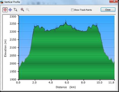
And all this can be done back home on a rainy day, using the data that the unit collected while it ticked away un-noticed in your pocket on the river.
This morning, Petro and I hiked to the top of a hill I hadn’t mapped before, and I diligently recorded the route, marking cairns at key points, gates and sources of drinking water.
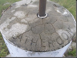
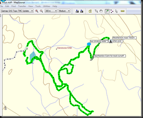
On our return I made us a good cappuccino each (on a coffee machine given to us as a wedding gift ), and I sat downloading the photos and the GPS tracks. As I did that I received a very sad sms, announcing the death this morning of my good friend and mentor, Bernard Talbot. The same Bernard Talbot, who with his brother Francois, gave me the GPS, and the coffee machine.
Go well my good friend. You taught me a great deal.
We will miss you.
3 Responses
Lovely post…..
How very sad about Bernard… I knew him too 🙁
A sad loss indeed.