Since I am more interested in rivers than history, I have yet to establish whether the original farms “Manor Farm” and “Brigadoon” actually share a common boundary or not. I have been busy working on a river instead of pouring over old surveyor general maps, which I would also like to do, if I could just find some time. What I can tell you is that you can see one farm from the other, and that the Umgeni River flows first through Brigadoon and then Manor farm. Brigadoon being on the southern bank, and Manor Farm on the northern one. The current owner of Brigadoon is our friend Russell Watson (who also happens to be South Africa’s most capped international polo player). And the owners of Manor Farm for many years have been the McKenzie family, that being the same family of the famous General Duncan Mckenzie. And it so happens that Russell is related (by marriage of his elder brother to the grand daughter of the brother of General Duncan Mckenzie), to the owners of the farm across and down from him.(‘”) Russell hails from farms in the Underberg district, including Seaforth (which happens also to be on a good trout stream), which was the family farm of the same MKenzie family into which his Brother married. Had my plans not gone pear shaped I would ,ironically, have been on the Umgeni at Brigadoon and five days later on the river at Seaforth. It could be seen as a migration in reverse of that of the bloodline, but only if you apply a lot of license, and as much imagination.
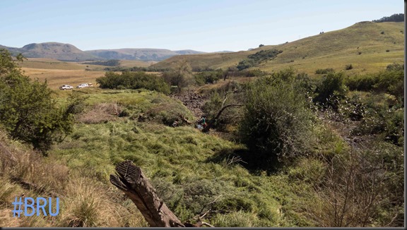
Lower Brigadoon, looking towards Manor farm
This interconnectedness and irony repeats itself everywhere. Take General Duncan McKenzie for example. He , among other things, built the road from Dargle to Fort Nottingham. With a bit of imagination you could say he built the road to Lions Bush, the farm of Peter Brown, since it is along that way. And then the politicians of the day go and re-name the Maritzburg freeway offramp to “Peter Brown offramp”, it having previously been named after none other than the man who built the road to Peter Brown’s farm: Duncan McKenzie.
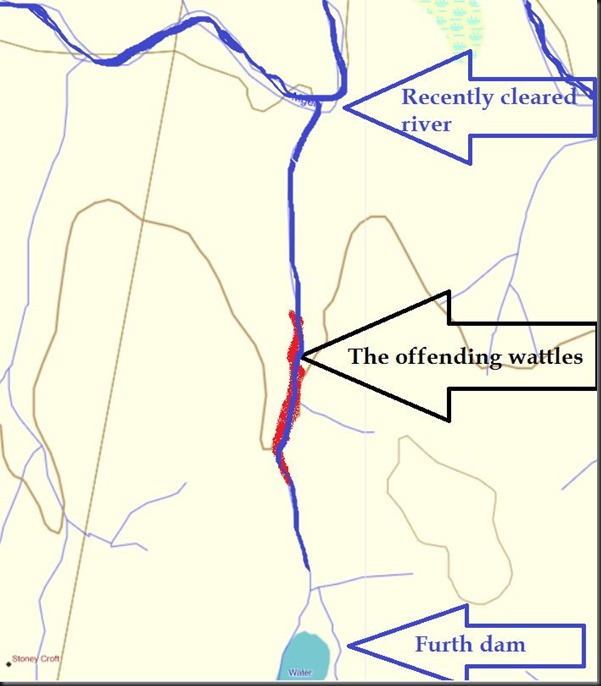
I didn’t say I had no interest in history: as you can see I love to roll around the connectedness of things through history. In the same way I like to roll around the connectedness of things in nature, and perhaps science too. I also have an interest in that river that runs through the farms of Watson and McKenzie, as many of you will know. We cleared some more wattle trees from that river two weeks ago. While we were doing that I noted that a particular tributary was flowing quite strongly, despite the recent drought. It joins the main river at a spot where I have caught Brown Trout before, and I wonder if the feeder stream is not perhaps cooler than the main river.
The small stream enters from the left , joining the main river in the dead centre of this picture.
Or maybe it has some favourable chemistry, the complexity of which we may never be able to measure or understand. Then again that side stream runs in a very tight kloof on Furth Farm. A kloof that will undoubtedly stay shaded much of the time due to the topography it enjoys. Unfortunately though, I noticed that the same deep kloof has, like the main river, become infested with wattle trees.
I would like to rid that tributary of those wattles, because it would improve the water flows further, but it gets me thinking: Do we just chop them down and let the trunks lie where they fall and rot there, or do we poison them standing. Either way, the wattle stems, with their tannins, and whatever other chemistry they may introduce to the system, will remain part of it for many years to come. So perhaps they need to be cut, cross-cut and removed. That will have to be done by hand, as no tractor will get in there. So it would be a monster task, and it would be a whole lot easier just to drop them where they stand. Or poison them. But what might the effect of that be on the water that runs through the farm that the daughter of my great grandson might buy one day? The effect that would be, of either the poison, or the rotting wattle trunks.
And that gets me thinking in turn: we are removing lots of shade from the river that should, by reasonable deduction, cause the water to warm up. Pre global warming (if indeed you believe in global warming), and pre wattle trees, the Trout thrived. So the clear-felled river should be fine right? Or have the invasive wattles cooled a river that would otherwise have become non-viable for Trout. Or were the natural forests bigger back then, and so the water not as warm as we might make it now. Perhaps we might need to plant some indigenous trees on the forest fringes to enlarge those forests again. Does anyone have very old photos of the pockets of forest, or do they appear on old surveyor general maps? Maybe we need to find time and go pour over those old maps after all, lest we poison our great grandchildren. Or at least dash their chances of quality Trout fishing on the Umgeni.
(Heck! In which case we had might as well poison them and be done with it.)
(yes, I refer to the great Grandchildren…not the Trout or the wattles)
‘* my information was gleaned from a book entitled “The first 100 years of the Underberg Himeville district”


2 Responses
Andrew, are the offending wattles in the kloof you speak of surrounded by indigenous forest? If so it may be possible that it will recover and take back the invaded area after removal. Just an observation but I have seen swathes of small gum removed and watched as the indigenous bush left behind has recovered to take back 50-60% of the area over a few years. Time consuming yes, but possible. As for the removal of the trees, does PDW not have indigent school boys to throw at the task?
Hi Hylton, These particular trees are in a north facing valley, so although its steep and narrow the sun gets right in there, and in its natural state it would be just grass. Indeed I think we should get some schoolboys in there! I have in fact just returned from a work party lower down….with schoolboys! Great to include the youngsters in the initiative.