The second Decad of April
Exploring the mid April chapters of fly fishing experiences over the years.
Exploring the mid April chapters of fly fishing experiences over the years.

A poster map of the upper end of Brigadoon, with anecdotes, explanations and features to enhance the flyfisher’s experience.
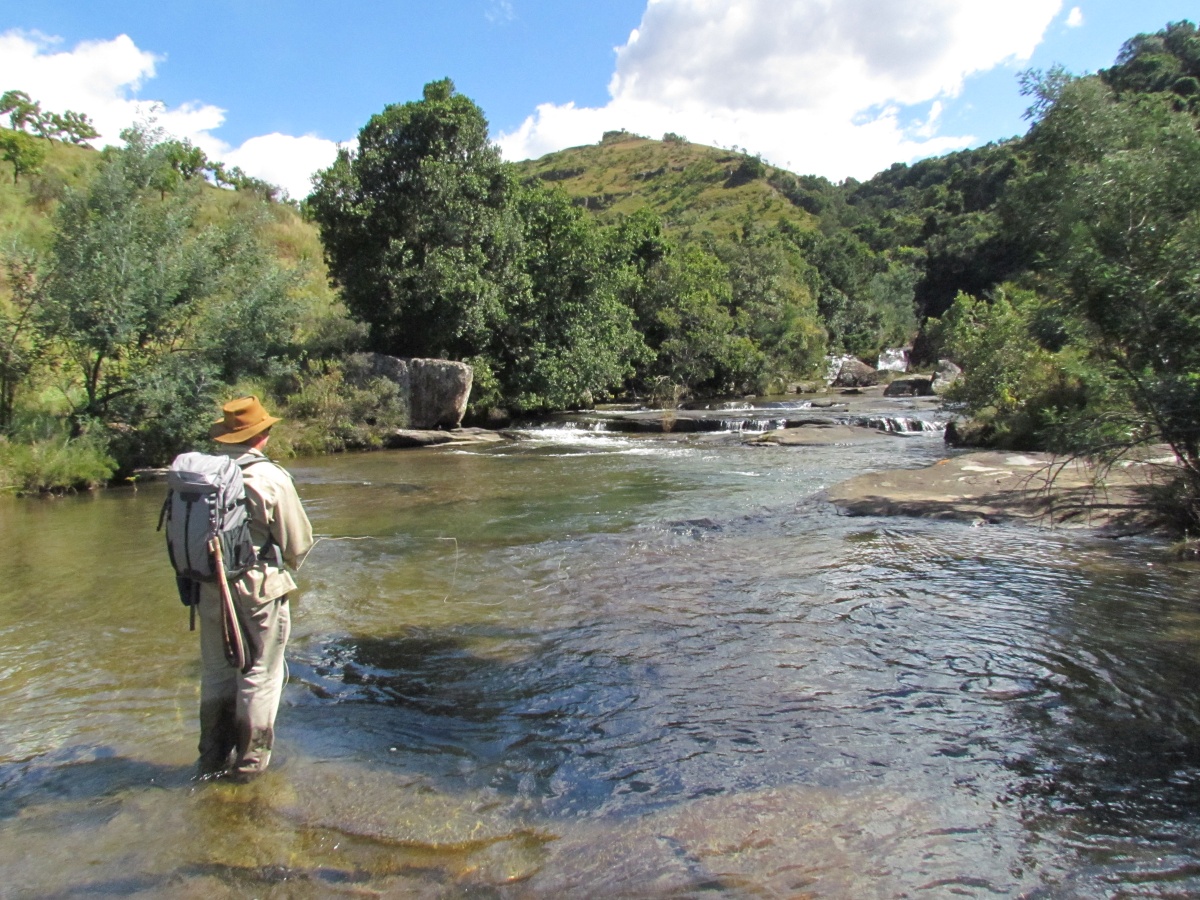
It was the 18th April 1999. Guy and I were fishing the uMngeni on Brigadoon, on what my fishing log describes as “Blacks Water”. That was the section of river above the confluence of the Furth Stream, and at some time not long past, it had been the farm of John Black, and if memory serves, Derek Fly had bought it or taken it over, and its length was now added to the beat known to us as Brigadoon. At that time all the riverside lands from the Furth confluence up to Picnic Pool were planted to maize, and the
“Hey laanie” “Heey Larnie” I ignored him. “Hey Larnie” ..he tried again. And then, proceeding to the assumption that I was in fact listening he added “How menny feesh in da sea?” He had spotted the fly casting decal on the side of my vehicle, and he abandoned his task of selling fruit at the roadside to connect with me as a fellow fisherman. I shouldn’t have been so rude, but he wasn’t reading it right. Neither was PD when he replied “60 fish…..hell I can’t remember when last I caught even 10 fish!”. “Easy tiger” I replied. “It was
I love maps. Let’s do a drill-down to my nearest Trout Stream here in South Africa: Firstly, for those outside of South Africa…. see below: Then, below is the detail of that purple rectangle above: And below again: Detail of that red elipse above, showing the major Trout Streams of the KZN Midlands. (the red dots denote the source of each stream. The copper line shows a significant ridge of high ground, with altitudes in metres above sea level along it. ) Pick out the Umgeni River above, and here below is a general locality map of the area closer
Since I am more interested in rivers than history, I have yet to establish whether the original farms “Manor Farm” and “Brigadoon” actually share a common boundary or not. I have been busy working on a river instead of pouring over old surveyor general maps, which I would also like to do, if I could just find some time. What I can tell you is that you can see one farm from the other, and that the Umgeni River flows first through Brigadoon and then Manor farm. Brigadoon being on the southern bank, and Manor Farm on the northern one.